
A decade ago, there were about 1,000 satellites orbiting Earth. Today, there are more than 12,000. Every day, those satellites generate mountains of data and imagery that companies and government entities deploy for a range of functions across agriculture and other sectors.
The interests of U.S. farmers, namely their vital role in national security, were major drivers of the National Aeronautics and Space Administration’s (NASA’s) expansion to include satellite-based observations of Earth more than 50 years ago. And some of the first companies to commercialize government satellite data — more than 30 years ago — were in agriculture.
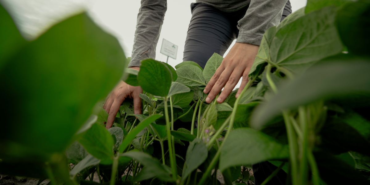
Precision agriculture data and platforms built upon satellite Earth Observation (EO) imagery have for years enabled Illinois soybean farmers to make informed decisions to monitor field and crop conditions and accelerate crop yield and quality. And for functions such as advanced crop monitoring and water management, this high-tech, 438-mile-high component of soybean production is just getting started.
A Look Back on NASA’s Satellite Ties to the Farm
A huge milestone in U.S. ag history happened July 23, 1972, paving the way for today’s precision ag toolbox for Illinois soybean farmers. That’s when Landsat 1, inspired by the NASA charge of “exploration, innovation and research,” was launched from a California Air Force base. It was the first in a series of nine satellites in the Landsat program to enter orbit. Today, those satellites generate images that can be transformed into maps that show details such as field nutrient density and provide guidance on farm practices such as precision fertilizer applications.
“In 1972, we couldn’t visit the Soviet Union to conduct crop scouting, so we needed an information source that could support American farmers in being globally competitive,” said Alyssa Whitcraft, Ph.D., Executive Director of NASAAcres, whose charge is to leverage NASA satellites for the benefit of U.S. farmers, ranchers and agrifood system decision-makers. “Landsat 9 was launched in 2021 and today, we collaborate with space agencies around the world as well as at home with the National Oceanic and Atmospheric Administration (NOAA) and the U.S. Geological Survey (USGS) to make satellite data more readily accessible to agriculture.”
The satellite sector exemplifies the evolution of technology. Over the past 50 years, and especially over the past 10 years, technology has advanced massively both in terms of the image quality satellites generate and their capacity for processing, storing and leveraging the huge amounts of data they generate.
“We’re in a much better position to go from large-scale monitoring and trying to just see what’s happening in another place in the world with production to actually serving farmers on their land. We have the right data characteristics and the ability to process that much data now, so that’s really where NASA Acres came from when we started in 2023,” Whitcraft said. “We are making that leap to take advantage of all of these years of innovation and this huge deluge of very high-quality data and start to work with farmers to directly support their decision-making and integration with the data they may already be collecting on farms.”
Today’s Advanced Satellite Capabilities and What They Mean to Farmers
As NASA satellite technology has evolved, it has advanced capabilities for farmers in two main ways. Especially in the past 10 years, Whitcraft said, image resolution (how detailed a satellite image can be) and the application of higher-quality imagery in indexes that monitor data points such as vegetative conditions have both made a “quantum leap” forward. That has enabled farmers to make informed decisions to better manage issues such as crop nutrition weed and insect pressures, and moisture extremes.
That all happens through three key characteristics of satellite sensors, or cameras. Together, they tell the story of crop health based on how light interacts with a farmer’s plants. Those resolution types are spectral (which Whitcraftt likens to the number of individual colors included in a box of crayons), spatial and temporal (how often the satellite captures an image). They all play into satellites’ increasingly detailed view of the condition of plants, such as soybeans in a field, based on a range of measurements taken from space. A drought-stressed soybean plant, for example, will interact with light differently and give off a different color signature than one with adequate moisture.
The more “crayons” a satellite has, the more nuances it can see in the degree of a crop’s drought stress. And the more often satellite passes capture images, the richer the view they provide on how much drought stress a crop is undergoing. As resolution continues to improve, satellite imagery can now give soybean farmers a new view of potential crop stressors, enabling quick, informed agronomic action.
“Plants experiencing disease stress will show up in the light spectrum differently than healthy plants, so we have to design sensors to be really sensitive to those types of changes,” Whitcraft said. “NASA satellite imagery can show large-scale crop progress and productivity all the way down to less than a quarter-acre at key vegetative and reproductive growth stages. We also have exciting work that is showing how satellites can predict soybean quality — things like oil, protein and starch content.”
These advances are products of NASA Acres collaboration with Kaiyu Guan at the University of Illinois; Katie Gold at Cornell University; Whitcraft; Ritvik Sahajpal, Natacha Kalecinski and Guanyuan Shuai at the University of Maryland; and a team led by Ignacio Ciampitti at Purdue University and Susan Metzger at Kansas State University.
Why NASA Satellite Data Is so Valuable to Farmers
The value of massive amounts of data to farmers grows exponentially when it’s viewed in a historical context with NASA’s best-in-class, highly accurate and precise satellites. That’s when crop modeling becomes possible based on farmers’ abilities to compare apples to apples for each crop year for a decade or more.
“I can compare data collected against the same time of year for the past 10 years and know because of NASA image quality that I am comparing apples to apples (sometimes literally) because the data are so consistent with one another over time and space,” Whitcraft said. “This also means that when we have real-world data from a farmer or from national statistics, we can ‘teach’ the images what 60-bushel soybeans look like versus 56-bushel soybeans, and you can start to predict yield because you’ll have those high-quality, comparable images again this year. That’s the incredible and unique legacy of NASA data.”
“And the more locations we have, the better our predictive capacity becomes because you can start to unpack why yields are what they are,” Whitcraft added. “That’s really exciting for helping farmers prioritize their management activities to maximize the ‘bang for their buck’ and their profitability.”
Partnering to Create More Value for Soybean Farmers
Collaboration is a big part of the work that Whitcraft and her team at NASA Acres do to help farmers. Partnering with researchers and faculty at a network of land-grant universities, including the University of Illinois, the NASA Acres team develops research that helps evolve how NASA satellite data can create new value at the farm level.
NASA Acres research projects all harness Earth Observation data to address critical agricultural challenges and foster profitable, sustainable management. One recent project on nitrogen management via satellite is led by Guan, a University of Illinois Agroecosystem Sensing and Modeling Professor who also serves as NASA Acres’ Chief Scientist. The project underway in Iowa, Illinois and Indiana this year will ultimately yield a “framework to integrate satellite Earth observations” to “support efficient fertilization management” through precise monitoring of nitrogen application rates, type, time and location, according to the NASA Acres website.
“These studies provide farmers with data-driven insights and innovative tools to optimize their operations, conserve resources, mitigate risks and adapt to environmental challenges,” Whitcraft said. “They ultimately lead to more productive, sustainable and resilient agricultural systems, exactly our vision for U.S. agriculture.”
If you’re interested in working with NASA Acres, start by contacting the team at nasaacres.org.
Recent Articles
This issue of Illinois Field & Bean spotlights the On-Farm Trial Network, highlighting how on-farm research drives real-world results.
By
High oleic soybeans have opened new doors of opportunity with their beneficial profile for human-grade food products and animal feed.
By IL Field & Bean Team